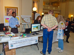
State Capitol to Celebrate 19th Annual GIS Day March 14th
“If you have a GPS system in your vehicle, on your cell phone or have created a map on a computer program to get somewhere you have already used a Geographic Information System (GIS) and may not have even known it. But you can touch and see how these incredible advances are impacting your life at the 19th annual GIS Day at the State Capitol March 14th,” explained Mike Sharp, state GIS coordinator.
“GIS integrates computer technologies, people, and detailed information about location that lets you visualize relationships, patterns, and trends in maps for better decisions. GIS can help you answer questions and solve problems by looking at your data in a way that is quickly understood and easily shared. GIS is any system for capturing, storing, analyzing and managing data and associated attributes which are spatially referenced to Earth,” Sharp said.
“Most people find learning easier if it involves visual items. GIS Day provides a great opportunity to see first hand the incredible ways these technological advances are impacting the world every day,” Sharp said.
GIS technology can be used for scientific investigations, resource management, asset management, environmental impact assessment, urban planning, cartography, criminology, history, sales, marketing, and logistics. For example, GIS might allow emergency planners to easily calculate emergency response times in the event of a natural disaster, GIS might be used to find wetlands that need protection from plant emissions or GIS can be used by a company to site a new business to take advantage of a previously under-served market.
GIS Day provides representatives from all over Oklahoma in the legislature to see how more than 45 federal, state, county and municipal agencies use this incredible technology every day to better serve the public.
More information, an invitation, list of exhibitors and photos from previous years is available on the Oklahoma Geographic Information Council website at http://www.okmaps.onenet.net/GIS_day.htm.