Oklahoma Conservation Commission team goes the extra miles for the future of Oklahoma’s wetlands
The concept seems simple at surface level.
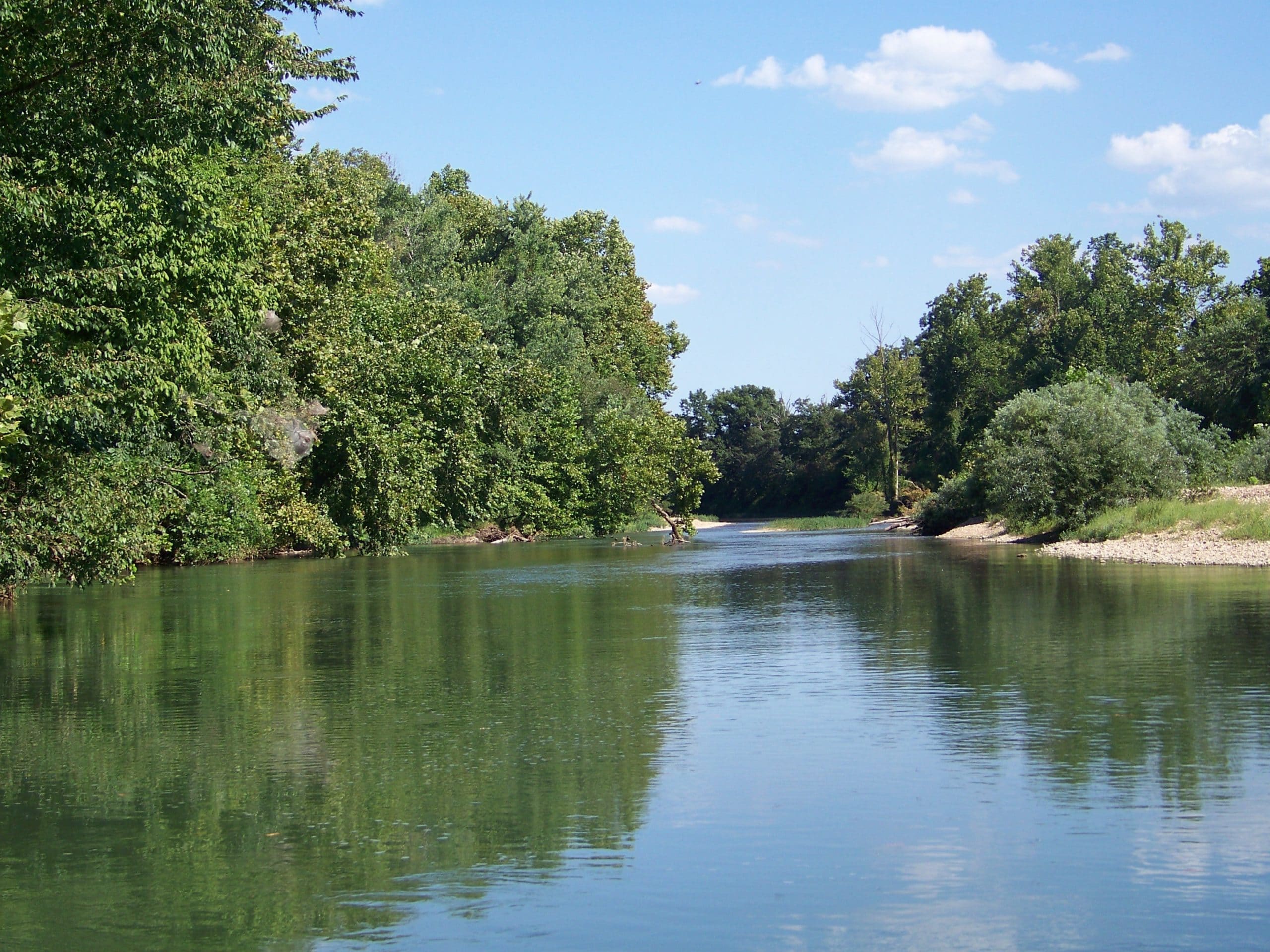
This summer the Oklahoma Conservation Commission’s (OCC) Wetlands Program traveled to and studied many of the different wetland areas across Oklahoma for the National Wetland Condition Assessment (NWCA). Wetlands are one of the five waterbody types in the National Aquatic Resource Surveys (NARS) and are studied once every five years.
This isn’t strictly a paper survey.
Nor, at the onset, is it a laboratory survey.
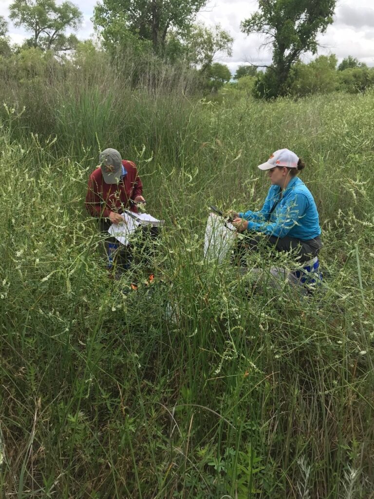
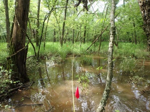
No, at one time or another for this survey of 35 wetlands areas in the state, the OCC staff walked over 9 miles, navigated deep water, and trudged through massive ragweed with dead growth reaching over 24 feet in length and the new growth as tall as 12 feet.
Then add on the weather. Due to their nature, humidity in wetlands is almost always near 100 percent. Actual temperatures climbed near triple digits. Toss in the fact that after the team gets in there, they exit the site with backpacks filled with soil samples weighing as much as 150 pounds – and sometimes the bags are passed over barbed wire fences.
Although this sounds like a really challenging summer, most sites were more easily accessed, and each location told a unique and interesting story.
And while the survey drains the OCC Wetlands staff physically, the information it produces and the good it will do inspires them, right down to the most specific details.
“Worth noting, is the plant diversity,” said Brooks Tramell, Director of Water Quality Monitoring, Assessment & Wetland Program. “We had a few sites with 70 plus species and a couple of sites with over 80 species of plants in the survey plots.”
The importance…
NARS, a collaborative partnership coordinated by the Environmental Protection Agency (EPA), was developed as the first comprehensive statistical survey to assess the status of and changes in the quality of the nation’s waterbodies.
State partners, like OCC, work to collect data within their state, and EPA compiles and analyzes the data with input from partners to provide a broad-brush appraisal of nationwide and regional wetland quality.
The project is important because of the functions that wetlands provide, including water quality improvement, groundwater recharge, flood water management, and critical habitat for wildlife important for recreation, such as ducks and fish. Data generated from this project will help wetland managers better understand the types of stressors affecting wetlands, where wetlands are most at risk, and how to improve management so wetlands can continue to provide important services to our citizens.
To accurately assess overall condition of the nation’s wetlands, data must be collected across the United States in a standardized approach.
This year, 1,000 sites across the nation, including the 35 in Oklahoma, were assessed. The sites were randomly selected from all areas mapped as wetlands. Those working on the project included: Tramell, Director of Monitoring Assessment and Wetlands and crew Leader for the project; Dan Dvorett, Technical Programs Director and botanist for the project; Sarah Gilmer, Water Quality Specialist and crew member; Cameron Sherbon, Seasonal Intern and crew member, and Greg Kloxin, Assistant Director of the Water Quality Division, who assisted with three of the toughest sites.
“Because wetland maps are not always correct, the first step was to determine if selected sites were indeed wetland and usable for this study,” said Dan Dvorett, OCC Wetland Program Technical Programs Director. “Then, we began the arduous task of locating and contacting landowners at the valid locations for permission to complete the assessments.”
Where permission was given, the crew studied indicators that help provide insight to the health and functions of the wetlands: vegetation, soil, water quality, water movement, and adjacent land-use.
Within a roughly 1.25 acre “Assessment Area,” a vegetation survey was completed, a 4-foot-deep soil pit excavated, and water collection was made when water was present. A soil profile was completed with soil samples sent to the NRCS National Lab for testing on nutrients and soil compaction. Water samples were collected to evaluate water quality.
Vegetation, water, and soil data are then used to assess wetland condition. For example, specific species of plants are adapted to wet conditions, and some are not tolerant to disturbance, so the plant community can provide a good indicator of wetland health.
Not the first, or second rodeo…
This summer marks the third round of NWCA data collection, with the first survey completed in 2011 and repeated every five years thereafter.
“The repeated assessment allows for not only a current estimation of wetland condition, but also an evaluation of how these important ecosystems might be changing over time,” Dvorett said. “Data from other years can be compared to determine if the nation’s wetland conditions are improving or declining and to identify any potential causes of wetland decline.”
In 2011, the NWCA project determined that about 50 percent of the nation’s wetlands appeared to be in good and 20 percent in fair condition. “Some of the problems found to affect wetlands were roadways, removal of vegetation communities, ditching to control water, and invasion of nonnative plants,” Dvorett said. “By understanding these problems, we can identify ways to work with landowners to voluntarily protect and restore wetlands and help ensure they continue to provide beneficial functions for the public and surrounding area.”