GIS Day at the Capitol 2008
14th Annual GIS Day at the Capitol Celebrates Successful
Mike Sharp, state GIS coordinator, called the 14th annual GIS Day at the Capitol a success. “We had 30 agency exhibitors and 125 registered participants,” Sharp said. Hundreds of visitors kept the exhibitors in the fourth floor Capitol rotunda busy from the event’s opening at 9:00 a.m. to closing at 3:00 p.m. on March 12. “I think we had the biggest turnout yet,” Sharp said.
GIS Day at the Capitol provides an opportunity for public sector agencies and organizations to showcase uses of Geographic Information Systems (GIS) throughout the state of Oklahoma. Sharp said visitors are asking more relevant questions and displaying higher awareness of using geographic information systems. ““If you have a GPS system in your vehicle, on your cell phone or have created a map on a computer program to get somewhere you have already used a Geographic Information System (GIS) and may not have even known it,” Sharp said.
“GIS integrates computer technologies, people, and detailed information about location that lets you visualize relationships, patterns, and trends in maps for better decisions. GIS can help you answer questions and solve problems by looking at your data in a way that is quickly understood and easily shared. GIS is any system for capturing, storing, analyzing and managing data and associated attributes which are spatially referenced to Earth,” Sharp said.
“Most people find learning easier if it involves visual items. GIS day provides a great opportunity to see first hand the incredible ways these technological advances are impacting the world every day,” Sharp said.
GIS technology can be used for scientific investigations, resource management, asset management, environmental impact assessment, urban planning, cartography, criminology, history, sales, marketing, and logistics. For example, GIS might allow emergency planners to easily calculate emergency response times in the event of a natural disaster, GIS might be used to find wetlands that need protection from plant emissions or GIS can be used by a company to site a new business to take advantage of a previously underserved market.
GIS Day provides representatives from all over Oklahoma in the legislature to see how more than 30 federal, state, county and municipal agencies use this incredible technology every day to better serve the public.
Some of the Oklahoma GIS projects that were displayed included:
• The Oklahoma State Department of Health (OSDH) featured a multi-media presentation that uses printed maps and animations to highlight GIS activities related to diabetes, tobacco use prevention, physical activity and nutrition, breast and cervical cancer programs, and EMS services throughout Oklahoma. The booth also summarized the results of a recent GIS needs assessment and highlight future GIS activities for the Health Department.
• The Chickasaw Nation Department of GeoSpatial Information has a rapidly growing Enterprise-level GIS. For GIS Day at the Capitol 2008, they showcased their latest endeavors. These tasks range from correcting data to a scale of 1:1500 to incorporating high-resolution aerial photography (Pictometry) into their data warehouse. The focal point of the exhibit was a new Chickasaw Nation intranet service currently being made available to Chickasaw Nation decision-makers. The new service is an ArcServer mapping site created through collaboration with IT NEXUS, of Denton, TX. The site features numerous layers including landholdings with trust and non-trust status, original Native American allotted lands, Chickasaw Nation facilities with contact information, and parcels with owner information for the entire Chickasaw Nation service area of 13 counties in south-central Oklahoma.
• The City of Ardmore has provided valuable information to the south-central region of Oklahoma for almost a decade. During this period, several datasets have been developed with over 100 individual layers currently available. GIS is currently utilized by every department throughout the city as well as seamlessly integrated with the Carter County’s E-911, EOC, & Assessor’s Office. http://www.gis.ci.ardmore.ok.us.
• Carter County has provided digital mapping for nearly a decade for Southern Oklahoma. In this time, they have developed seamless integration between the City of Ardmore GIS Department with Carter County’s E-911, EOC, & Assessor’s Office. With the recent development of the Carter County GIS Department, they are moving forward with centralizing and developing new datasets for Carter County as well as continuing to provide seamless digital mapping between Carter County and the City of Ardmore for Southern Oklahoma.
• The Oklahoma Corporation Commission demonstrated GIS usage in Field Operations and the OCC’s online databases.
• The Oklahoma Water Resources Board demonstrated its GIS web applications designed to provide water resource data to the public and other agencies. The OWRB # also be showcasing the new Oklahoma Water Atlas.
• The City of Midwest City highlighted its ongoing process to incorporate spatial data and spatial analysis into all areas of its municipal functions. Included were examples of how GIS has aided Midwest City in making important decisions related to municipal planning and customer service, including FEMA floodplain analysis and land development suitability analysis. They also presented their future plans to distribute mapping and analysis capabilities across the enterprise and to their citizens.
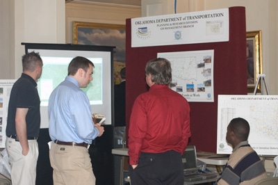
• The Oklahoma Department of Transportation demonstrated GRIP 3, GRIPLite (public access), and their proof of concept GRIP Google (viewable in either Google Maps or Google Earth). They also had several posters depicting some of their work, as well as one or two from their Environmental Division depicting some of their projects.
• Oklahoma City Community College promoted a new GIS Emphasis and GIS Certificate in the Computer-Aided Technology Program.
• The Oklahoma Department of Mental Health and Substance Abuse Services presented maps detailing ongoing efforts related to Suicide Prevention and Methamphetamine Prevention in Oklahoma. Suicide Prevention maps include a view of their widespread suicide prevention training efforts, treatment admissions for suicide, rates of suicide by county and more. Methamphetamine Prevention maps include: methamphetamine treatment by county, effects of legislation on methamphetamine treatment, a nationwide comparison of methamphetamine lab seizures, county involvement in methamphetamine prevention and more.
• The Oklahoma Wind Power Initiative (OWPI) researches and promotes wind power and other sources of renewable energy and is also active in outreach and educational activities. At GIS Day, OWPI demonstrated a use of ArcIMS to display environmental and wind resource information to serve interested community and individual stakeholders as well as wind power developers.
• The Oklahoma Department of Agriculture, Food and Forestry has an extremely broad mission and a wide variety of mapping applications. A few of the items that on display included: fires and emergency response, ethanol plant, CAFO, poultry, livestock auction and fertilizer facility locations, forest health survey, crop dusting drift complaints, airport wildlife hazard survey, invasive species and Internet mapping.
• INCOG displayed the Tulsa Police Department Sex Offender 2,000’ radius map, Tulsa Area Potential Rail Lines map, Zoning Atlas Book and Regional Corporate Limits map.
• The Cherokee Nation GeoData Center is committed to mapping the Cherokee Indian Communities. The Cherokee Nation Community Services department, which is traveling to each county to meet with community leaders and local residents, has worked with GeoData to record community boundaries for both the 2000 and the 2010 Census. Using these Census Designated Place (CDP) files, Census statisticians are able to provide us with information regarding Indian populations. The CDP’s provide a much clearer picture of income, education, and health numbers among Cherokee citizens than just the Census tracts and block groups. GeoData is also working on the Cherokee Nation Data Sharing and Data Quality Policy for Cherokee Nation this year, as well as beginning work on their interactive website for CN residents.
• Oklahoma One-Call System, Inc. (Call Okie) is a non profit corporation funded by underground facility owners working together to provide safety to excavators in Oklahoma. They demonstrated the benefits of detailed mapping by following the life cycle of a locate request from initial excavator contact to delivery of the request to the facility owner.
• Oklahoma Department of Wildlife Conservation has two ongoing research projects in which GPS transmitters were placed in a sample of paddlefish and blue catfish in Lake Texoma. Tracking of fish will allow managers to better understand seasonal movement and habitat preferences, to improve future sampling and management strategies. Data from the first year of these two projects presented. The Department also demonstrated the online Wildlife Management Area Digital Atlas.
• The Oklahoma Department of Environmental Quality exhibiting maps made by the Land Protection Division’s Superfund Program. These maps are used to graphically display Superfund site information. The DEQ demonstrating how to use a population statistics model created by the Superfund Program to calculate population and public drinking water supplies within a 4-mile radius of sites. DEQ also demonstrated the Agency’s Data Viewer available on the DEQ’s website.
• The U.S. Geological Survey in cooperation, coordination, and partnerships continues to provide leadership in the areas of integrated science and geospatial data discovery, access, and delivery through a variety of science and national geospatial data programs.
• The Oklahoma Conservation Commission Water Quality Division uses GIS technology to target “hotspots” of nonpoint source (NPS) pollution within priority watersheds, based on factors such as soil types, climate, land use, topography, and stream data. The OCC’s Fort Cobb Watershed Project was showcased to demonstrate how the integration of all of this information allows optimal planning of practices to reduce NPS pollution to streams and provides expected load reductions of pollutants due to implementation of these practices.
• Oklahoma County Assessor’s Office showcased their online GIS mapping site. The use of GIS maps, aerials and assessment data is crucial for local Governments and the community in regards to emergency management, planning, economic development, real estate trends, ownership information and more. By integrating their CAMA data with their GIS data and creating a public access system that communicates securely and in real time with “live” data, their users can now access this information anytime anywhere on the internet.
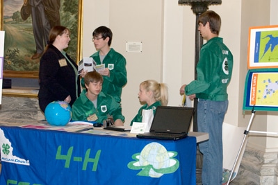
• The McClain County 4-H Geoclovers are a 4-H youth geospatial project club whose members work as a team utilizing GIS and GPS technology to assist the citizens of McClain County. The youth have created a recreational land use map of the Purcell Lake and are currently working with county and city emergency management personnel to map rural fire hydrants and city infrastructure for the county’s E-911 system. The group has had their work featured at the National Council for Geographic Education’s annual conference, attended a multi-state youth emergency mapping conference, been selected as the poster group for 4-H’s national initiative into the geospatial emergency mapping area, and featured in OSU’s Cowboy Journal magazine – all from a group whose average age is 14!
• The Oklahoma Department of Libraries highlighted handouts about different depository libraries through out the state and some Info on the different workshops they provide to libraries about GIS/Mapping throughout Oklahoma.