Conservation Commission Partners to Assess High Hazard Dams

The Oklahoma Conservation Commission (OCC) and the USDA Natural Resources Conservation Service (NRCS) have begun a project to perform assessments on 141 Upstream Flood Control Dams in the state. Of the more than 2,100 such dams in the state, the 141 under study are rated as “high hazard” due to the potential threat to human lives should one of them breach during a flooding event. The purpose of the project is to examine all considerations with regard to the rehabilitation of each dam and identify the highest priority candidates for rehabilitation.
The project entails collecting all existing data for each dam, performing an on-site inspection, analyzing the breach areas and developing a breach inundation map, documenting all potential damage locations, performing failure and risk index computations and determining all potential rehabilitation alternatives. In determining rehabilitation alternatives that meet current NRCS and state standards, cost estimates are developed based on recent contracts for similar work including the cost of removing at-risk structures where that is a practical alternative.
In a narrative report with photographs and appropriate attachments, a final assessment report for each dam will include the following:
- Description of the condition of the existing dam and appurtenances
- Breach inundation map for the entire structure
- Status of the dam’s operation and maintenance
- Potential conceptual rehabilitation alternatives including site-specific restraints
- Estimated cost ranges for the identified potential rehabilitation alternatives
- Completed NRCS National Watershed Manual Exhibit 508.1 Priority Ranking Spreadsheet
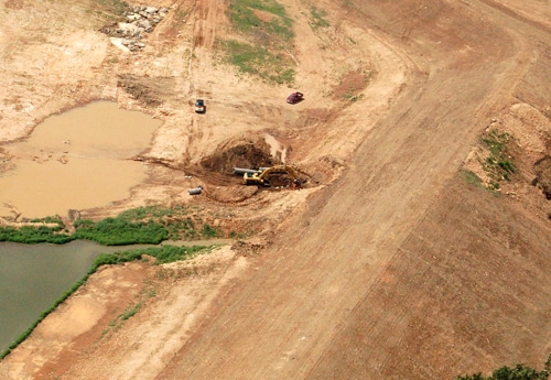
OCC’s Conservation Programs Division is overseeing the project using OCC employees with help from NRCS. OCC/CP watershed technicians George Moore, Johnny Pelley and Dennis Boney are conducting the on-site inspections along with photographing the site and videotaping the interior of the spillway pipe whenever possible. Ray Riley, OCC/CP engineer also makes a site visit to review and supplement the documentation of the watershed technicians. Riley and Jim Henley, OCC/CP GIS specialist, prepare aerial photos and maps including a preliminary breach inundation map. Riley reviews the map in the field, takes measurements of bridges and culverts and documents each potential damage location (PDL). Henley and Riley work to finalize the inundation map, prepare a PDL database and complete documentation for breach analysis. Henley then prepares the final breach inundation map and PDL summaries. Larry Caldwell, OCC/CP engineer, is coordinating the project. OCC part-time employees Lil Holkum and Dwain Phillips are participating in the project, with Holkum providing clerical support and Phillips providing technical writing and editing support. Gary Utley, NRCS hydraulic engineer, is providing technical expertise throughout every phase of the process.
The completion date for the project is Sept. 30, 2011.
“Funding for rehabilitation assessments has been the weak link in the chain of necessary steps that result in the rehabilitation of a watershed dam,” said Robert Toole, OCC/CP director. “When the opportunity for assessment funding presented itself, the Conservation Partnership in Oklahoma moved quickly to collaborate on a proposal, which resulted in full funding for our entire project” he said. “This has placed a stress on the Partnership due to the short timeframe for completion but it will be a tremendous benefit to our conservation district sponsors and a boost to Oklahoma’s rehabilitation efforts. It behooves the local conservation district partnership to make these assessments a top priority and provide the necessary local assistance,” Toole said.
